Showing posts with label Elegant Trogon. Show all posts

Monday, June 11, 2012

Fledgling Trogons!

Wow––6 trogons in South Fork this morning! My first glimpse was of a plump bird, breast on, perched on a creek boulder. That breast showed a big white crescent, framed above and below by dark, and my first thought was, surely not a Ring Ouzel! Surely not, indeed. Through binoculars it resolved into a fledgling trogon with darker-than-normal feathers framing the big white breast crescent.

Later I saw a second fledgling, accompanied by an adult male and possibly the sibling of the first, though they were separated by about 100 yards. This second youngster didn't look as dark below the chest band, and allowed a closer approach. Its tail, while showing copper, wasn't as bright as the tail of the first fledgling. Here it is:

Fledgling Elegant Trogon, front and back (Photos by Narca)


Up at the trailhead, two male trogons were contesting territorial rights. The younger male foraged, plucking insects from spider webs. Mostly the action was quiet, and the two even perched side by side for a while. But all it took was the arrival of a female trogon, and suddenly the two males were grappling mid-air!

Two male Elegant Trogons are sizing up each other.

The older male is warning away the younger with a bit of tail-flipping, prior to combat.

The underside of the tails of these two birds reveals their age difference: the bird on the left shows the heavier barring of a one-year-old male in his first summer of life. The bird on the right shows much finer barring under the tail––the pattern of an older male. The year-old bird also shows an anomalous white feather within the green of the breast. If that pattern holds true through future molts, we should be able to identify this individual in years to come.

Interestingly, none of these three adult males was the same as the male at the known nest. That male (often seen near the bridge) has an anomalous dark feather within the white breast band. He also has a mate, so it appears that at least 8 trogons, including the two fledglings, are in lower South Fork. It also appears that the trogon census missed some! Possibly running it in May instead of June, as customary, resulted in the census's low figure of 8 individuals for the entire Cave Creek drainage. (The June counts sometimes record fledglings; one year on the count a trogon fledged right before our eyes, and landed at our feet, stub-tailed and blinking at the world.)

Other fledglings were also out and about: young Bridled Titmice, young Painted Redstarts. The Painted Redstart fledglings are at that stage when birders unfamiliar with the plumage sometimes think they are seeing a Slate-throated Redstart. Today one of the young redstarts was a black-and-white blur, not yet showing a smidgeon of red, flycatching in the gloom beneath the big willow at the South Fork bridge.

Even a young Northern Goshawk came roaring in, perched briefly, glared at me, and flew off, kek-kek-kekking. A word of advice to the young trogons––¡Ojo!––keep your eyes open! 


Early morning in South Fork


Wednesday, June 6, 2012

Aahh, the Benefits of Exercising...

...in South Fork!
Elegant Trogon male (Photos by Narca)

For one, you may glimpse an Elegant Trogon descending to the creek bottom for a drink. This male was hover-sipping from a rill of water spilling between boulders, just as he would hover before a tree to pluck fruit.


For another, you might find new blooms of Butterfly Milkweed...

Butterfly Milkweed, Asclepias tuberosa

...or of Scarlet Penstemon.

Scarlet Penstemon, P. barbatus

For a third, an Apache Fox Squirrel could scamper across your path. In the US, this mammal lives only in the Chiricahua Mountains.

Apache (or Mexican) Fox Squirrel

A Variegated Fritillary could cross your path...

Variegated Fritillary, Euptoieta claudia

As the poet Rumi wrote, "The breeze at dawn has secrets to tell you. Don't go back to sleep. You must ask for what you really want. Don't go back to sleep.... The door is round and open. Don't go back to sleep."

Now, that was a good walk, was it not?

Monday, August 22, 2011

Huachuca Canyon with WFO

Our immersion in Huachuca Canyon, emerald-green and moist in this monsoon season, was a balm. One of the morning field trips at the Western Field Ornithologists' annual meeting explored this beautiful canyon, which is less often visited than neighboring Garden and Sawmill Canyons. Tony Battiste and Adam Searcy ably led the group.

At the mouth of Huachuca Canyon in the Huachuca Mountains
(All photos by Narca)

Some of the out-of-state folks had never seen an Elegant Trogon, so that species was a big highlight, as were a couple of juvenile Gray Hawks begging frequently and chasing after harried parents.

Immature Gray Hawk in Huachuca Canyon

Mary Gustafson pointed out a field mark on the young Gray Hawk that I hadn't been aware of: look at the tail bands. Those bands become increasingly thicker toward the end of the tail. This mark, Mary says, is reliable for separating young Grays from young Broad-wings.

Elegant Trogon male in Huachuca Canyon

A charming Canyon Tree Frog swam across the stream where it crossed the road. I don't see this amphibian very often. Its eyelids gleamed with glints of gold and copper.

Canyon Tree Frog in Huachuca Canyon

Overall the migrants still seemed low in number, but we did see a number of the resident "trophy" species of southeast Arizona: Sulphur-bellied Flycatchers, Hepatic Tanager. I saw a Violet-crowned Hummingbird, which appeared to be mobbing something at the back of an oak tree. They will mob Northern Pygmy-Owls, but if an owl was present, it didn't show.

A fair-sized Black Bear in Huachuca Canyon

The decision of how far to walk upcanyon was made for us: a big cinnamon-shaded Black Bear was lapping up berries at the side of the road and was loathe to abandon his feasting spot.


Out on the grasslands, singing Cassin's and Botteri's Sparrows gave everyone great views; a Greater Roadrunner was sunning in a clump of yuccas; and a gorgeous Painted Grasshopper added a burst of color to the scene.

A sunning roadrunner exposes the black bases of its back feathers to soak up more sun.

A spectacularly-marked Painted Grasshopper

As always, the WFO meeting was great fun. About 180 people attended, and both field trips and the science sessions were excellent. The annual meetings are renowned for the appearances of great rarities, with so many skilled field biologists scouring an area, and this was no exception. An Aztec Thrush wowed Homer Hansen's group in Garden Canyon.

Next meeting: Petaluma, California. Go! You'll love it.

Tuesday, August 2, 2011

New Life

A quick flash to Portal, Arizona, before we continue with Spain: This morning's walk up the South Fork road with long-time friends, Chet and Irma, affirmed that new life is thriving there.

Just below the South Fork bridge, a Wild Plum is fruiting. (Some people call this tree a Wild Cherry. Either name works for Prunus americana.) Feasting on those fruits were a family of American Robins and a juvenile Elegant Trogon. It is good news that at least one of the few trogon pairs that attempted to nest this year has successfully raised their chick. Any birders headed up South Fork will enjoy watching this tree, to see what might be attracted to the bounty. It is immediately next to the road, on the creek side, a short distance below the bridge.

Wild Plum (Prunus americana) in fruit
(Photos by Narca)

A mother Coati was attempting to corral her rambunctious kits and lead them away from the bipedal, optic-laden strangers coming up the road. Nursing worked to catch their attention for about 2 seconds, but there was too much world to explore!


They don't herd any better than cats––better just carry them by mouth!


Stash them on a tree trunk.... Maybe they'll stay put there.


For 5 seconds, anyway!


Sunday, June 26, 2011

South Fork, with Trogons

Today the annual census of Elegant Trogons in Cave Creek Canyon was allowed to happen, under an exemption to the Forest closure issued by District Ranger Bill Edwards. (Thank you, Bill!)

Rick Taylor will be releasing the final tally when he has pored over the data, but it appears to be quite low this year (not surprising). Roughly 8 trogons were found––all of them in South Fork, and none in the main canyon. That is surprising! In a more normal year, the tally would be twice that, and in one year, Dave Jasper found 21 nests.

After the fire (Photos by Narca)

Several of us were stair-stepped up South Fork, beginning with Terry Morgan and Karen Walz along the road and up to the bridge, then including Maya Decker, Heidi Fischer, John Yerger, Morgan Jackson, Alan Craig, Peg Abbott, me, and Richard Webster at the highest elevation above Maple Camp.

My territory ran from about 1/3 mile below Maple Camp, up to that much loved site, and it happened to be the most intensively burned part of South Fork that any of us saw. Even there, however, the burn was mostly moderate, and several of the big maple trees look as if they will survive, even though many other trees growing on that same terrace have been reduced to charcoal.

A surviving maple, with Maple Camp behind it

Maple Camp vignette: a maple leaf caught in Arizona Pine bark

A hazard tree at Maple Camp

These photos represent the most intense burn that I saw, so take heart! The overwhelming sentiment among the others in our small group was that the burn wasn't as bad as they had expected. (It was pretty much exactly what I expected.)

Only a few patches of green relieve this more intense burn, approaching Maple Camp. Fire also ran up the peak behind.

Another fairly intense patch in the South Fork bottom, but even here some of the sycamores retain green leaves.

This Sotol, with its root mass, rolled down from the cliffs when Horseshoe Two burned through South Fork Canyon.

Very striking was the new growth on many of the burned trees. A few root masses were burned out, but most of the trees will likely survive (if they survive the continuing drought). Burnt mounds of Deer Grass were sending up new shoots. Scorched Rocky Mountain Maple, Arizona Walnut, Velvet Ash, Arizona Sycamore, Arizona Madrone, Sandbar Willow, and several species of oaks were all sprouting tender new leaves. One clump of Golden Columbine bloomed. Grape vines were emerging. False Indigo was sprouting abundantly––when that flowers, it will be a big bonus for butterflies in search of nectar.

An Apache Pine regenerates needles

This charred Arizona Walnut wears an anklet of green.

Butterflies themselves were very scarce. I saw a single small satyr, a single Red-spotted Purple, a single Two-tailed Swallowtail.

Red-spotted Purple, photographed in a more clement year

The center of my territory was the trailhead for the Burro Spring Trail. A small but good chain of pools attracted butterflies, dragonflies, birds, foraging Yarrow's Spiny Lizards, and one Cliff Chipmunk. Miraculously, Speckled Dace survive there. In the last 6 months, these tiny fish have endured severe freezing, extreme drought, and now the fire.

Speckled Dace in a small pool at the Burro Spring Trailhead

Although the canyon seemed quieter than wont in my area, a pair of Painted Redstarts and a pair of Dusky-capped Flycatchers both gathered food for nestlings. An American Robin was gathering nest material, perhaps for a second attempt. A Northern Pygmy Owl called upslope, and a Zone-tailed Hawk sailed past. A young male Arizona Woodpecker was near adults. All these signs of new life were heartening.

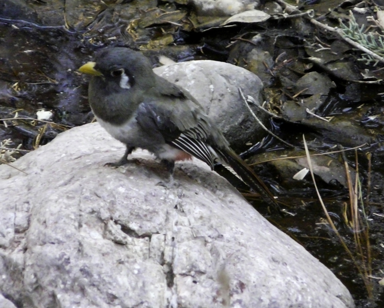
When the trogon flew in, he came silently. For a few moments he paused in a scorched maple, then continued silently downstream, to be seen by Peg in the adjoining territory. Farther down, Alan saw a pair of trogons just above the Bathtub; those were both calling.

The only Elegant Trogon I saw today, a male with a soot-stained tail

Peg and I both felt like witnesses to a friend's travail. There seemed little we could actually do, beyond acknowledging the canyon's wounding, its survival with challenges still to come, its great importance as a place in our lives. I once met a group of Chiricahua Apaches as they emerged from the South Fork Trail, having just gone up canyon to drum for their ancestors in that sacred landscape. Many people, having hiked even once in South Fork, feel the place's indelible mark on their spirits.

South Fork is resilient. It survives, with trogons.

Amid the desolation, a yucca blooms.

Sunday, July 4, 2010

Silverleaf

The first hint of something extraordinary is all the activity along the South Fork road, just below the bridge. A dozen Black-headed Grosbeaks forage on the ground and munch breakfast in the branches overhanging the road. Apache Fox Squirrels nestle in the sprays of leaves. Acorn Woodpeckers are very busy, doing what they do best. A big Silverleaf Oak––one of the biggest I've ever seen––has produced a bumper crop of tiny acorns, and word of the feast has spread.

Acorn of Silverleaf Oak (Photos by Narca)

Normally Silverleaves are shrubs or small trees, associated with Madrean Evergreen Woodland. This giant stands about 40 feet high, with its roots well-watered by the nearby spring. (Google tells me that the national champion is 85 feet high, so our South Fork champ is just a teenager!) Like other oaks of arid climes, the leaves are leathery to resist water loss. The name comes from the leaf's silvery, reflective underside.

Underside of Silverleaf Oak leaves

In a good year, many animals thrive on the acorn crop, and last winter's El NiƱo rains have brought on a true bounty of acorns. I tasted one and it wasn't bitter––the amount of tannin in acorns varies with both species and individuals. Native Americans harvested acorns, prizing the best-tasting (such as Emory Oak), and giving special treatments to those that were bitter from tannin. This particular tree's acorns must be especially good-tasting, to attract so much attention from diners, while the surrounding oaks are ignored, at least for the time being.

Acorn Woodpecker caching food
(Mixed media by Narca)

Acorns alone don't account for the feeding frenzy happening today near the South Fork bridge. There also must be plenty of insects in the vicinity of the spring. Flurries of flycatchers––Brown-crested and Dusky-capped, Sulphur-bellied, Western Wood-Pewees––add to the tumult, while a male Blue-throated Hummingbird squeaks from the top of the Silverleaf and a Painted Redstart tumbles from tree to tree. An Elegant Trogon still maintains his territory near the bridge. Plumbeous Vireos, Bridled Titmice, and Brown Creepers search for food for growing nestlings.

Ahh, South Fork. How good it is to walk here again!

Thursday, June 3, 2010

Now We Wait

Last night's fire update in the Portal Rescue classroom was again a valuable exercise in explaining what has been accomplished toward containing the fire, and what we can anticipate. PortaleƱos packed the place, listened, asked questions, and aired concerns.

So far, the fire in South Fork continues to burn at the desired low intensity. Most of the canopy within the burned area of South Fork is still intact. Fire is just reaching the canyon bottom in the vicinity of Maple Camp and higher. We are moving beyond the first big hurdle in what promises to be a month-long crisis. A containment date has been set for mid-June; however we are cautioned that a containment date and a controlled date are not the same. A contained fire has the management plan well in place and holding, but it is not yet controlled.

The fire has not been spreading south of the main burn during the past day or two.

A new, more elaborate fire map added a major feature to the now-familiar fire perimeter (which currently encompasses 37,000 acres) and to the updated extent of the burn: now the map includes a number of interior lines, each labeled as a "MAP" or Management Action Point. (We labored through a lot of acronyms tonight!) A MAP is a trigger point. When the fire reaches that position, it triggers a cascade of new management decisions and actions, all determined by the fire's behavior at that time. Actions may include running a new fire model, encouraging more low-intensity burning, and/or evacuating residents in different parts of Cave Creek Canyon.

Many residents were encouraged that the village of Portal now lies just outside the projected fire perimeter line. We are cautioned that smoke from the fire is expected to get worse, especially as it draws closer to town and as it makes any uphill runs. During the recent period of low-intensity burn, we've seen little smoke.

Any action the crew takes will depend upon the fire's behavior and the type of habitat fueling it: oak habitat is handled differently from pine. Does that fine a level of management imply that we can control this thing? As long as the wind behaves, and other variables fall into place... that's what we're led to believe.

Tonight the crews will begin to employ a new tactic: dropping "ping-pong balls" from a helicopter to set fire along certain ridgelines, ahead of the main fire. (In fire parlance, a "ping-pong ball" is a PSD... no, that doesn't help... a Plastic Sphere Dispenser... or was that a DAID, a Delayed Aerial Ignition Device?)

Whatever you call it, the idea is to slow the fire's advance, to keep it burning at a low intensity by starting another fire ahead of it. Fire on a ridge backs down into canyons much more slowly, in contrast to the blast of higher-intensity fire that often happens when it burns uphill. Burning at night when temperatures are cooler, humidity higher, and winds calmer, also encourages a low-intensity burn. So now that the fire is reaching the bottom of South Fork, the goal tonight is to burn ahead of the fire on the opposite ridge, anticipating the fire's run uphill, to try to keep a low-intensity fire going on the further, western side of South Fork canyon, too.

Paul Hirt spoke to the benefits of this fire, if crews are able to maintain a low-intensity burn. He's right. We've had 100 years of fire suppression and fuel build-up, and as long as this continues to be handled skillfully and if the wind continues to cooperate, the habitat stands to benefit considerably in the long term. Once it's behind us, the longer-term prospects for a catastrophic fire are diminished.

Biologists from the Forest Service expressed hope that most tree-nesting birds will survive the burn. Although they didn't mention ground-nesting species like Painted Redstarts and Red-faced Warblers, those are obviously much more vulnerable; however most adult birds should be able to move out of harm's path. Special care is being taken around the known nest territories of Spotted Owls (another acronym cropped up here––you really don't want to know).

Spotted Owl (Pen and ink by Narca)

We're walking a fine balance, and so far, so good. Most preparations are in place, and now we wait.

Glenn Klingler is still considering running the near-annual trogon census about the third weekend in June, but that is entirely dependent on the fire's behavior then. Public safety will be the paramount factor.

The community gives its hearty thanks to everyone working so hard on the Horseshoe Fire and our best wishes for a speedy recovery to the two firefighters who were injured while working the firelines, and who were airlifted to Tucson. I hear that a new sign has gone up in town, complete with balloons, expressing those thanks. (Delane, did I get that right? Balloons? Ribbons? Colored flagging, such as has appeared on various street signs and structures around the canyon?). The fire team also very sincerely thanked District Ranger Bill Edwards and the other employees of Coronado National Forest for their big help and cooperation, saying that such cooperation isn't always forthcoming.

(A note to Hizzoner the Mayor––a.k.a. Howard Topoff: after seeing up close how a real government agency functions, I don't think we have enough acronyms in Portal.)

Wednesday, June 2, 2010

South Fork Today: the Horseshoe Fire

Last night smoke from the Horseshoe Fire made sleep difficult. When the smoke eased, I slept in––until a phone call from Helen Snyder had me out of bed and out the door in 15 minutes!

We met Jim Payne and Ron Kaczor, both public information officials assigned to the fire, at the Visitor Center in Cave Creek Canyon, and they took Helen and me into South Fork for a firsthand look at fire preparations in that much-loved canyon.

Horseshoe Fire Map, day by day growth

I'll summarize the situation first, then go into details of what we saw. The fire is now backing into the upper reaches of South Fork, its growth slowed by light, upslope wind. Debris fall from burning trees carries it downslope. It is burning into the region above Maple Camp and is expected to reach the canyon bottom by tonight. So far (incredibly, in the view of experts here) flames running into the canyon have only been 6 inches to 3 feet high in most places––perfect for a low-intensity burn. No one expected it to behave as sedately in South Fork as it has thus far done.

Firefighters identified two scree slopes on opposing walls of South Fork and built a fire line between them. They will try to hold the fire at that line, in the upper reaches of the canyon. During the 1994 Rattlesnake Fire, they anchored the fire lines on ridgetops, only to see line after line blown away by that inferno, in a terribly frustrating loss of effort. Helen and I talked to firefighters who had also worked the Rattlesnake, and they said that they had been "well-schooled" by that fire. One laughed and said that he had never wanted to be assigned to the Chiricahuas again because of the exceedingly rugged terrain, and he has refused other assignments here. Yet he's back now, helping in South Fork.

Discussing fire map with Jim Payne & Division subchief
(Photo by Helen Snyder)

As we drove into the main Cave Creek Canyon, we saw where fire crews have been cutting back brush from along the road, for the most part taking small trees and shrubs. Next step is to come through with a big chipper, and to reduce all the cuttings to woodchips, which are left along the roadside.

Preparations at cabin in South Fork (Photo by Narca)

In South Fork, nothing has been "brushed" except in the immediate area of the two cabins just above the bridge. There, trees were left standing, and the undergrowth was completely removed and raked away. Sprinkler systems have been set up around both cabins (as is being done around residences in the main canyon). Otherwise, South Fork––so far––is as it was, a rich tangle of riparian habitat where the calls of nesting trogons echo from the cliff faces.

Fire crews assemble in South Fork (Photo by Narca)

At the trailhead was a fire-jam of firetrucks, firefighters, and safety officers. One was manipulating computer images on a laptop, atop the roof of his truck. His program was the most sophisticated use of Google Earth I've yet seen. There was the terrain around South Fork, with the current fire perimeter and all the technical information about the landscape needed for studying and implementing their strategies.

High-tech fire-fighting, with Helen Snyder looking on 
(Photo by Narca)

Showing the crew a trogon nest 
(Photo by Helen Snyder)

Trogons are exerting their charm over the workers here. A male repeatedly landed on one of the picnic tables, in full view of crews assembling in South Fork early this morning. Several of the firefighters trailed after us to look at a nearby trogon nest. They wanted to hear about the richness of the canyon and the factors that create its high diversity. Our community is tremendously grateful for their hard work.

Portal-style fire command center (Photo by Narca)

Sunday, May 30, 2010

The Horseshoe Fire

All of my fellow PortaleƱos, as well as the birding community, are following closely the development of the Horseshoe Fire, here in the Chiricahua Mountains of southeast Arizona. As of Saturday night, May 29, just over 1200 acres have burned in the heart of the Chiricahua Wilderness.

Horseshoe Fire at 2 AM, May 30, a 30-second exposure 
(Photos by Steve Cullen/Light Buckets)
And a 10-second exposure, both taken 10 miles from the fire

At last night's community meeting, fire supervisors told us that this promises to be a very difficult, very large fire, which will most likely burn until the monsoon rains arrive. If the fire burns to the perimeter line that firefighters hope to establish, it will be as large as 35,000 - 40,000 acres. (For comparison, the huge 1994 Rattlesnake Fire, which burned for a month, covered 29,000 acres.)

A team specializing in Type 1 fires––the most challenging––is here with 700 firefighters, including 19 Hot Shot teams. In all of the US there are 100 Hot Shot teams, so the commitment of nearly 20% of the nation's most proficient fighters of wildland fires indicates how seriously the fire experts are regarding the Horseshoe Fire. The Type 1 team here in Portal also responded to 9/11 in New York City.

The combination of terrain, fuel load and weather conditions makes this fire so difficult to handle––in the US, the fire supervisors told us, the Chiricahuas present as rugged a terrain as it's possible to find.

Fire perimeters have to be drawn so that the segments all connect to ring the fire. Given our rough terrain, it was impossible to make the perimeter any smaller. In steep, narrow canyons, flaming brands "jump" from one side of the canyon to the other, and so, in that situation, fire defeats all efforts to contain it.

Even after our good winter rains and snow pack, the moisture load of down fuels––logs etc––is low at only 6%. (Lumber for building usually has twice that moisture content.) However, the living trees are well hydrated and should withstand fire better than is often the case here. We hope to see a mostly low-intensity, mosaic burn which would benefit the habitat. We fear a high-intensity, stand-replacing, uncontrollable conflagration.

Fire supervisors see no way of keeping the fire out of South Fork, a major branch of Cave Creek Canyon renowned for its extraordinary biodiversity. To lower the impact, firefighters will concentrate on manipulating the fire when possible to lower its intensity, and thus avoid as much as possible the catastrophic, stand-replacing holocaust we experienced with the Rattlesnake (when fire burned from Methodist Camp all the way to the top at Rustler Park in 2 to 3 hours). Another goal is to protect the old growth riparian corridor along South Fork. Team members are very aware of its high biological value.

The fire investigators told us that the Horseshoe Fire was human-caused, and that it is virtually certain that illegal immigrants are responsible, once again. It began at Burro Springs, near the ridge between Horseshoe and South Fork Canyons. Deep frustrations were expressed at the meeting over the entire situation involving both illegal immigration and drug smuggling, and the suffering experienced by the border communities, which bear the brunt of a failed immigration policy and of the passage of many thousands of illegal entrants, in the form of fire ignitions, damage to pristine habitats, home break-ins, assaults, ambushes between rival cartels, and one recent murder. But that is another subject indeed....

Portal itself, while located right on the fire perimeter line, is in no imminent danger. Unfortunately, all of the homes up canyon from Portal fall inside the perimeter. For the moment, the American Museum of Natural History's Southwest Research Station is not in danger. Much depends on what the winds do during this coming month or two, and upon when the rains come––if they come. (Last year the monsoon essentially didn't come, and summer drought was intense.)

Two nights ago I drove with Gary Rosenberg and his group to go owling in the high Chiricahuas. Returning from Onion Saddle, we were sobered and deeply impressed by the expanse of twinkling hotspots spread beneath us, where trees stood as torches in the night, and the full moon rode above the wrack of smoke. Sleeping was difficult for me that night. It is hard to see this treasured canyon go through a crisis of these proportions, and to know that the research station and so many homes (including our own) are under threat. Yesterday as we helped friends to evacuate their cabin above the research station, a pair of Elegant Trogons was coming and going from their nest cavity, their home also in grave danger.

Elegant Trogon in South Fork (Watercolor by Narca)

My sadness lifted a little when I remembered a grassland fire that Alan and I helped to fight in 1992 on the Gray Ranch. After the fire was under control, I walked back through smoking stubs of bunch grasses, and a single Grasshopper Sparrow hopped up onto a still-smoldering grass-snag in the midst of the black desolation, and began to sing.